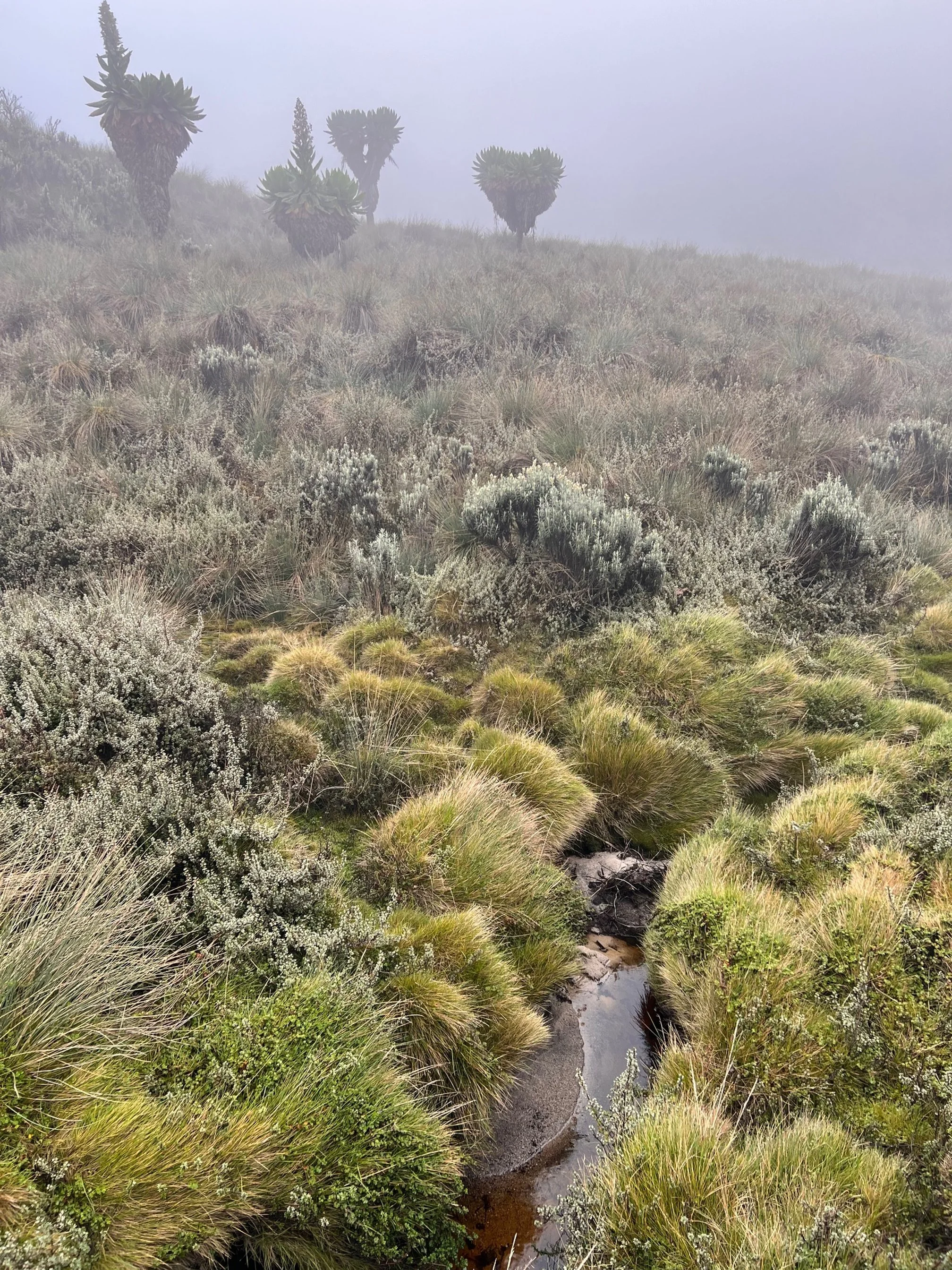
Rwenzori Mountains, Uganda.
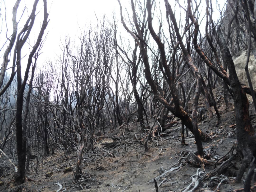
Climate change is driving wildfires to higher altitudes, where tropical forests with no burn history are destroyed.
What happens next? We investigated the multi-hazard cascade after an unprecedented 31km² fire in Uganda’s Rwenzori.
Local Industry Worker
“2013 - that was when we were all surprised. I could not believe what I saw”
Local resident
“We had never seen floods like this before. We were not prepared.”
Why tropical mountain fires matter
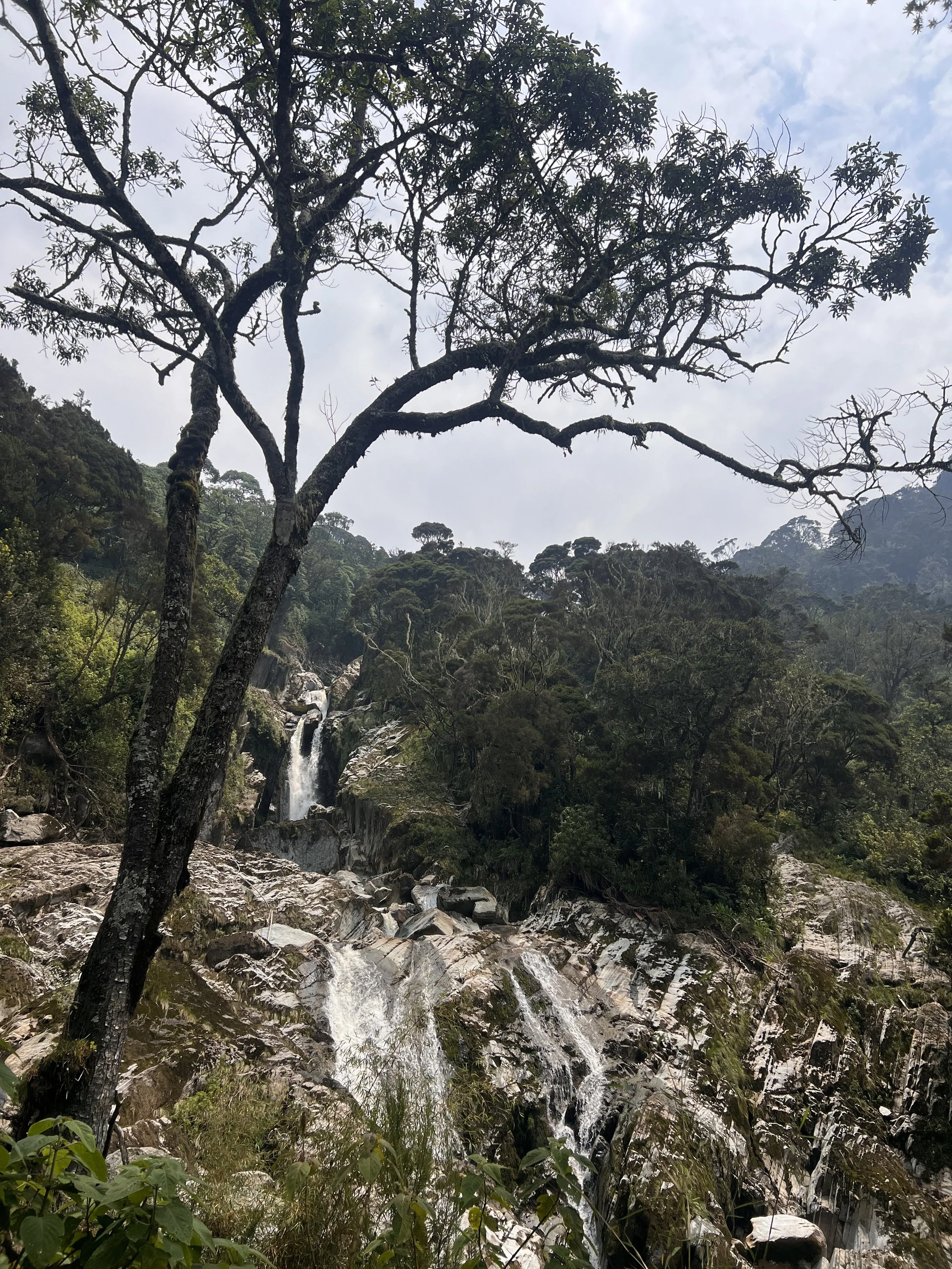
Tropical mountain ecosystems cover almost two million square kilometres worldwide.
They provide the headwaters of rivers like the Nile, Amazon, and Mekong, and support the livelihoods of over 300 million people.
When they burn, the impacts are not confined to the mountains — they spill downstream into farms, towns, and entire regions.
The fire
In February 2012, a wildfire swept across 31 km² of pristine forest and wetlands in Uganda’s Rwenzori Mountains.
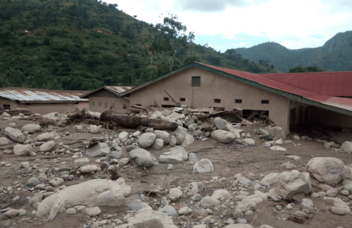
The first flood
Just fifteen months after the fire, in May 2013, the Nyamwamba River unleashed a devastating flood.
More than 25,000 people were displaced, 13 lives lost, and over $4 million in damages recorded.
An unprecedented flood. Yet, the rainfall itself was not extreme, recorded as just a 7-year event. But with forests gone, the catchment could no longer hold back the water and sediment as it used to.
Local Government Official
“the burning is the reason we are now having the floods annually… we know how useful wetland vegetation is in controlling floods, releasing water slowly”
Local resident
“the moss was like a big 1 m thick sponge, it soaked up all the rain… 20 or 30 km² of rock that was once boulders covered in moss is now bare”
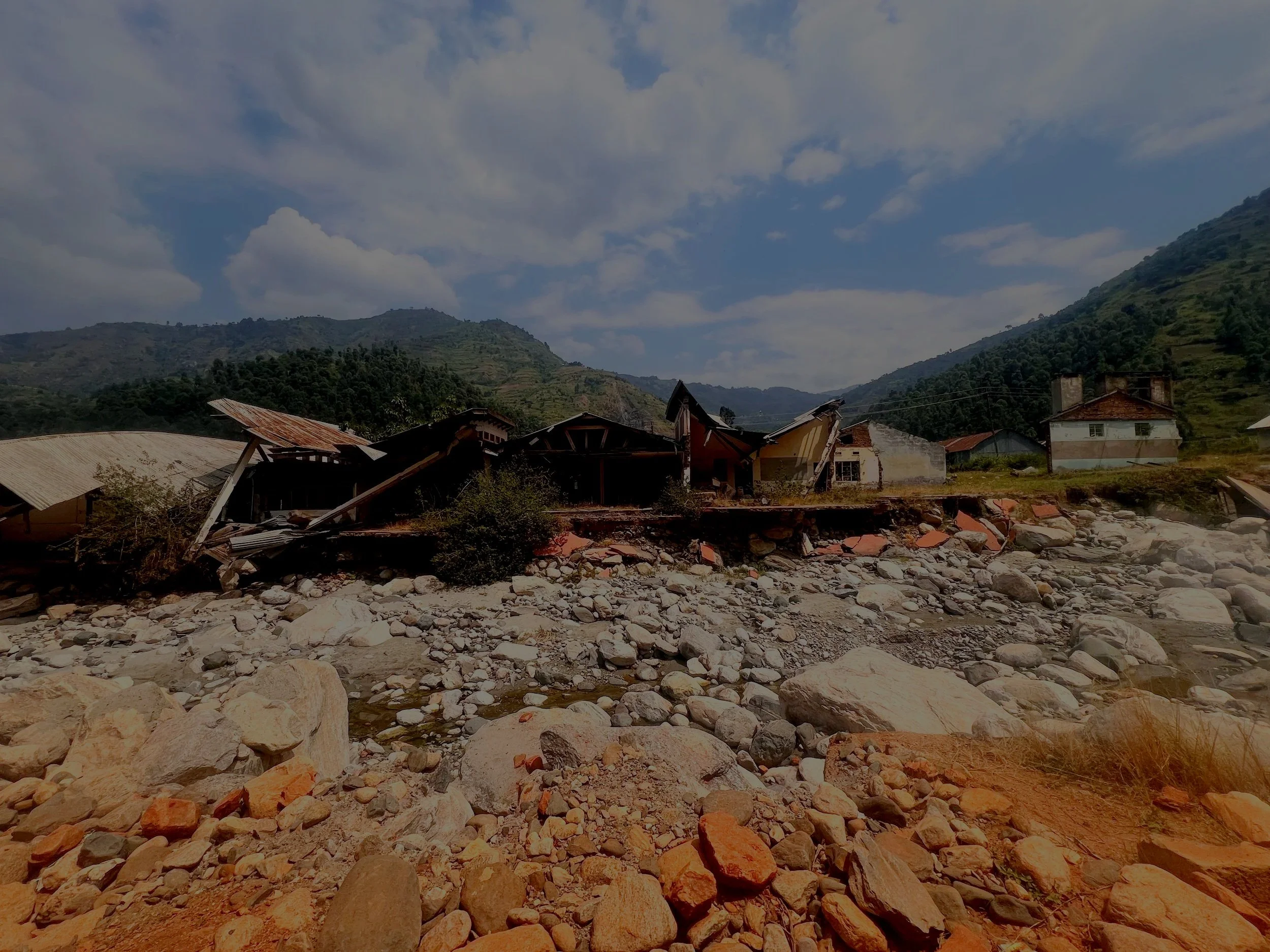
The sixth flood
In May 2020, the Nyamwamba flooded again — this time on an unprecedented scale.
Over 170,000 people were affected, thousands of homes were damaged, and Kilembe’s hospital was submerged.
Local workers and residents
"It was an 800 cumecs flood… higher than our professional hydrologist’s modelling of a 1000-year flood event”
---
“entire mahogany trees were coming down as flood load”
---
"moving rocks two times the size of a minibus"
---
"suddenly, I heard a roar like a plane taking off at Entebbe Airport. Two landslides cut off the river and created a dam behind it, then soon after there were entire trees pole vaulting over the debris"
---
"It was an 800 cumecs flood… higher than our professional hydrologist’s modelling of a 1000-year flood event” --- “entire mahogany trees were coming down as flood load” --- "moving rocks two times the size of a minibus" --- "suddenly, I heard a roar like a plane taking off at Entebbe Airport. Two landslides cut off the river and created a dam behind it, then soon after there were entire trees pole vaulting over the debris" ---
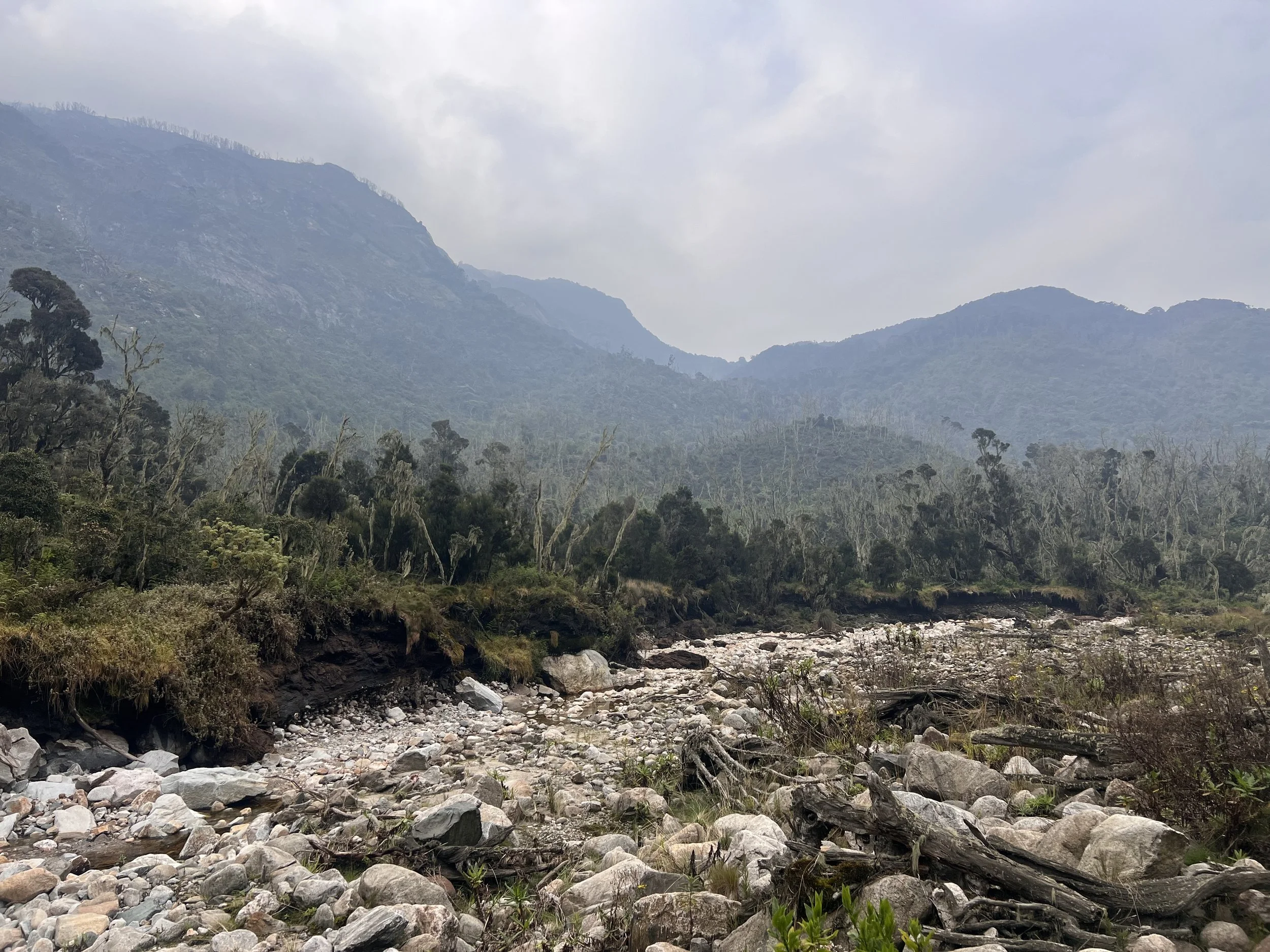
The Hazard Cascade Unfolds
Increased water and sediment in the river caused erosion and landslides along the River Nyamwamba’s banks.
This creates a positive feedback, where the generation of new sediment provides tools and power to accelerate further erosion and landslides. Since the fire, the river has now widened 7x.
From there, the cascade continues…
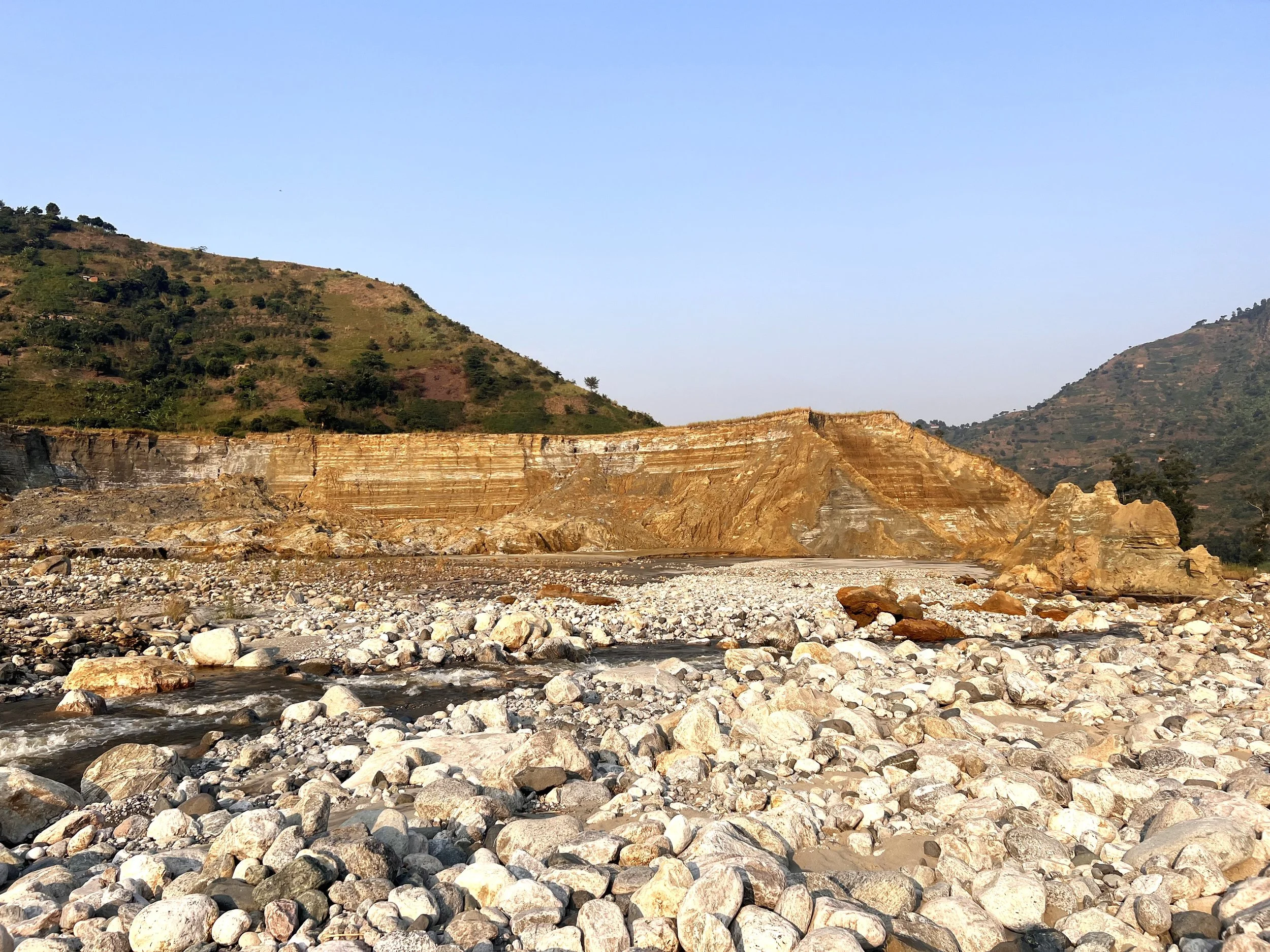
Pollution
As the river widened and eroded its banks, it tore into 15 mega-tonnes of abandoned Kilembe copper–cobalt mine tailings.
Since 2014, an estimated 744,000 tonnes of solid waste have been washed into the Nyamwamba River.
The river is a drinking water source for thousands, and it deposits sediment in arable soils. There are growing fears of long-term health impacts.
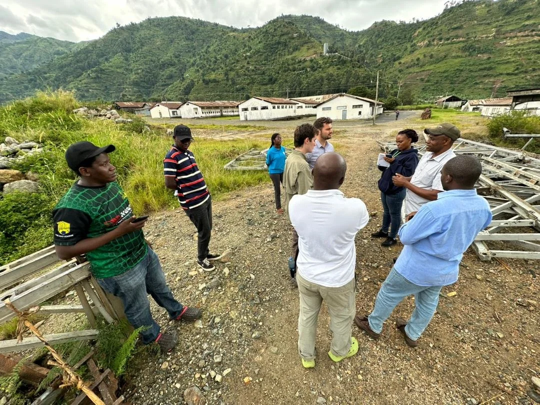
Our work
This story is still unfolding. The Rwenzori wildfire shows how one event can spark a decade of cascading risks with floods, landslides, erosion, and pollution. But it also shows the urgent need for science, monitoring, and action.
Our team at Imperial College London and Makerere University is working with partners at the Red Cross and Ministry of Water and Environment in Uganda and to map the hazard cascade, capture local knowledge, and identify ways to break the chain. By combining satellite data, field surveys, and community voices, we aim to build a clearer picture of how fire reshapes mountain risk and what solutions are possible. We are also supporting these solutions, providing technical support on engineering and flood early warning system design.
The study is about more than the Rwenzori. Similar ecosystems worldwide are becoming vulnerable to fire for the first time. Understanding what happened here will help guide preparedness and management across tropical mountains, so that small fires don’t become long-term crises.
Interested in our work?
Get in touch with our team.
Imperial College London
William Veness (also Geology for Global Development)
Martha Day (leading a PhD on wildfire and flood relationships in tropical mountains)
Anthony Ross
Jiayuan Han
Wouter Buytaert
Makerere University
Yazidhi Bamutaze
University of Reading
Douglas Mulangwa (also Ministry of Water and Environment, Uganda)
Elisabeth Stephens (also Red Cross Red Crescent Climate Centre)
Ministry of Water and Environment, Uganda
Callist Tindimugaya
Brian Guma
Andrew Musigwa
Uganda Red Cross Society
Emmanuel Ntale