Groundwater monitoring, Somalia
Groundwater supplies the majority of domestic water in the Horn of Africa, and it is a critical lifeline during droughts.
Yet groundwater monitoring remains scarce. Reactive, data-poor water management systems face cyclical collapse when droughts and other pressures strike.
At Imperial College London & Concern Worldwide, we investigated why this data scarcity still persists, and future solutions.
“how can we manage what we do not measure?”
-UNESCO (2022), Making the invisible visible
Veness, W. A., & Buytaert, W. (2025). Towards an evidence base for groundwater data investments. Environmental Science & Policy, 164, 104014. https://doi.org/10.1016/j.envsci.2025.104014
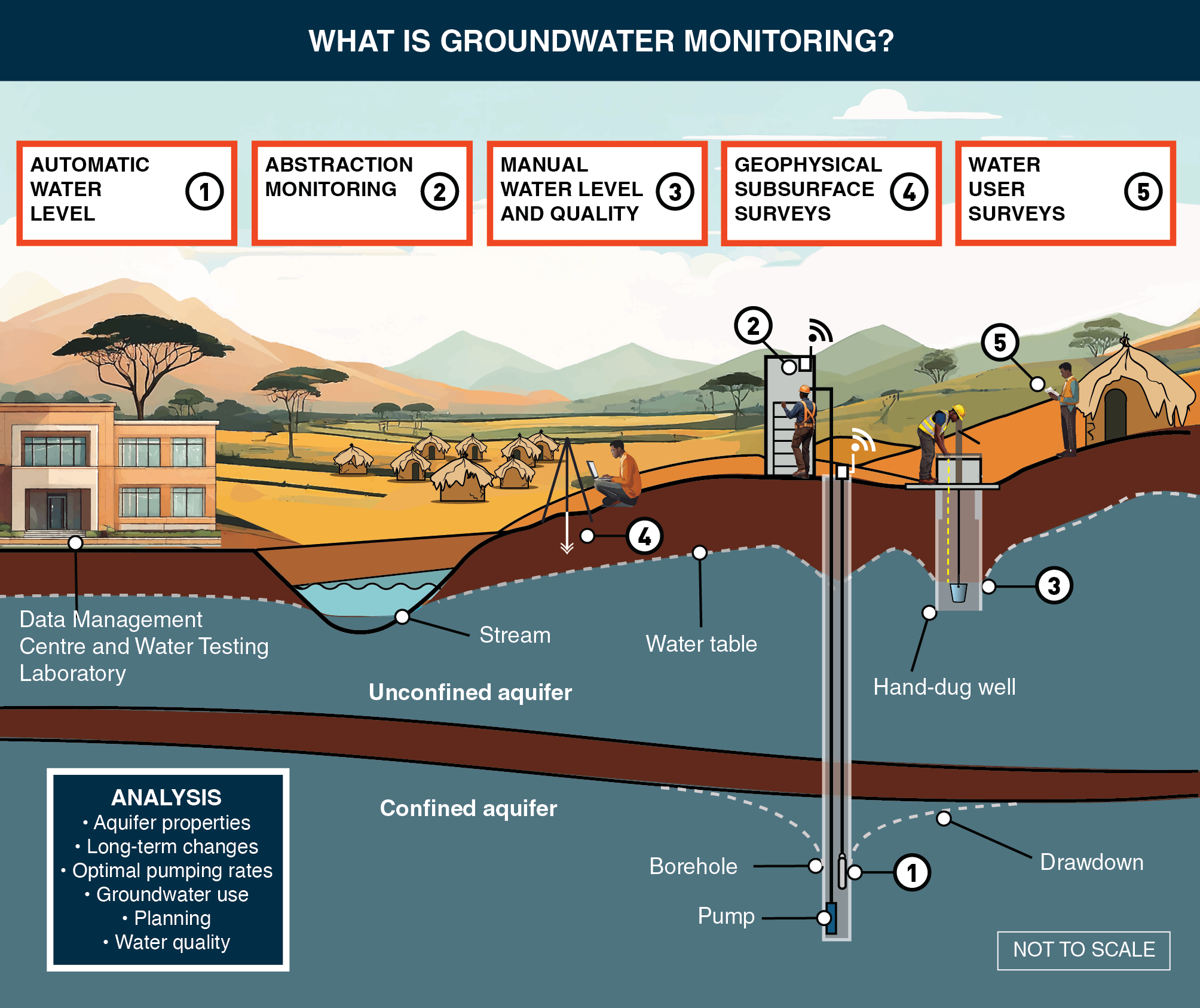
What is groundwater monitoring?
1. Water Level Monitoring
Sensors or dip meters track aquifer response to rain, pumping, drought.
2. Abstraction Monitoring
Flow meters show how much water is being used.
3. Water Quality Monitoring
Handheld tests check pH, clarity, salinity, or contamination risks.
4. Geophysical Subsurface Surveys
Surface tools map underground geology, guiding water discovery and drilling.
5. Water User Surveys
Community insights reveal usage patterns, problems, and local water pressures.
Why does groundwater monitoring remain scarce?
Through literature review and 42 expert interviews, we identified 2 key reasons.
Reason #1: No clear value proposition
There was little documented information on why groundwater monitoring is important.
In other words, the actual benefits of groundwater monitoring remained unclear, leaving funders uncertain whether it is worth the cost.

Reason #2: Persistent operational challenges
Even when projects were launched with good intentions, many failed.
Those running monitoring systems faced many setbacks including: maintenance costs, access issues, limited technical capacities, discontinued funding and loss of interest.
With funders remembering these past failures, financing for the practice had dried up.

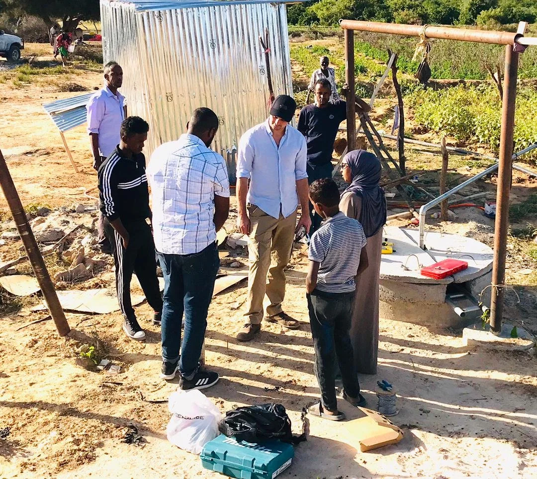
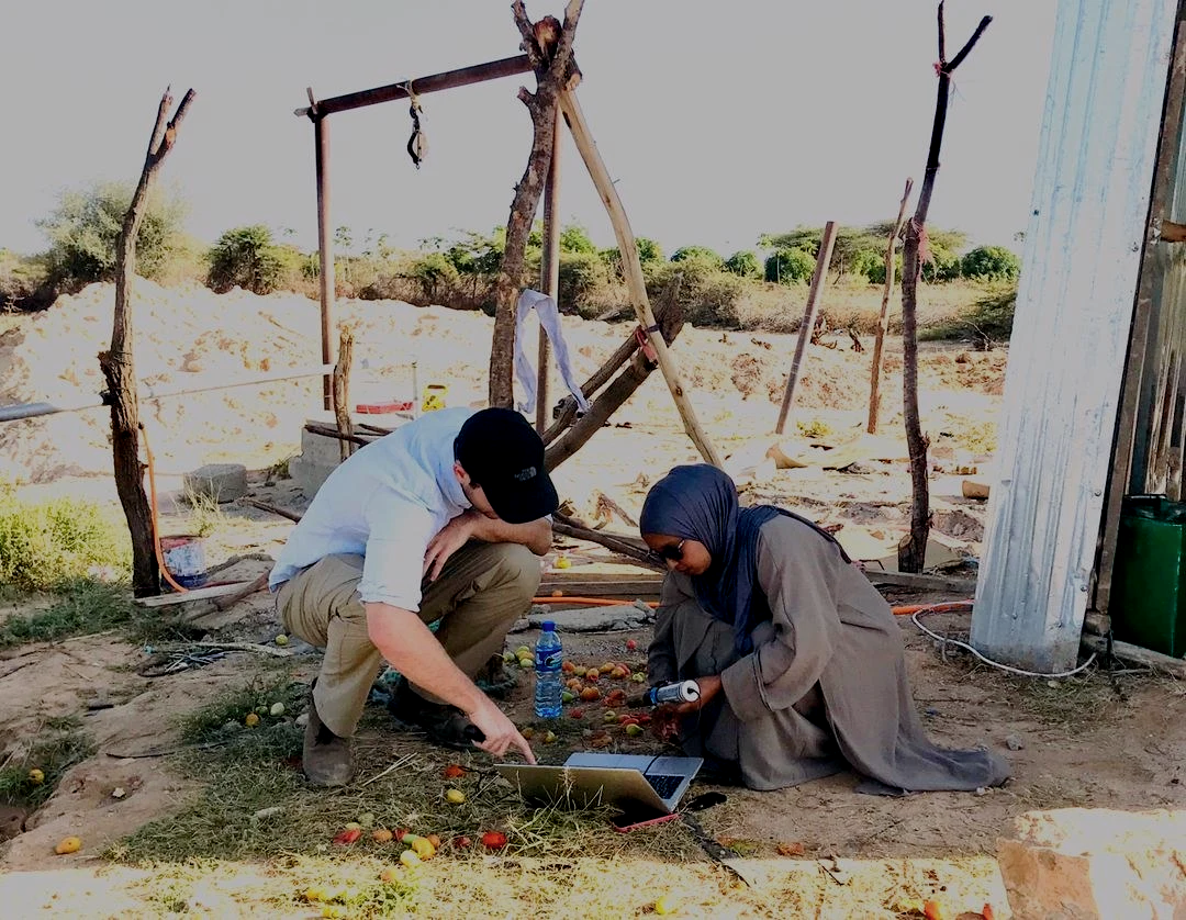
We interviewed 42 experts across the Horn of Africa, with a focus on Somalia and arid & semi-arid lands (ASALs), where groundwater is most critical.
We aimed to:
Map the benefits of groundwater monitoring data to start building its value proposition.
Identify the operational barriers as perceived by experts.
Compile expert-recommended solutions to reduce these risks.
Our work:
1 Mapping the benefits
This diagram shows how different groups use and benefit from groundwater monitoring data.
By qualitatively mapping these benefits, we build a foundation for future studies that can quantify impacts and returns on investment.

NGO Expert in Water, Sanitation and Hygiene
“some kind of data is a totally fundamental prerequisite for any action – you can’t have informed, proactive action without the data being there.”
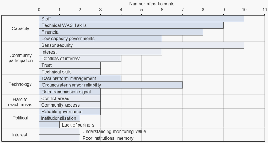
2 The Barriers
We grouped the barriers to groundwater monitoring mentioned by experts into themes.
3 The Solutions
We then built a 5-step framework summarising expert recommendations for best practices that address many of these barriers.
And we discussed solutions further in the paper:
Veness, W. A., & Buytaert, W. (2025). Towards an evidence base for groundwater data investments. Environmental Science & Policy, 164, 104014. https://doi.org/10.1016/j.envsci.2025.104014
-
Don’t rush into drilling or dropping sensors. First, agree on who needs the data, how it will be shared, and how it will be maintained.
-
Run district-level pilots where “strategic” boreholes are critical in dry seasons. Use simple methods (like manual monitoring) where they’re more reliable than expensive kit.
-
Once pilots prove their worth and earn trust, scale up step by step to more districts.
-
Make monitoring and reporting part of borehole drilling licences, backed by professional training and standards. This creates accountability and long-term commitment.
-
National water authorities (with local partners) should run data centres that manage, analyse, and share the information. External partners can support with training and technology.
The bigger picture
This research is about more than groundwater monitoring in Somalia.
All types of local hydrological monitoring (rainfall, river, water quality…) remain scarce, especially in development contexts:
We still don’t fully understand the value of data to different users.
We haven’t done enough to map the barriers to implementation or how to overcome them.
Building the investment case, and practical solutions that lower the investment risk of these programmes, is key to improving data coverage, which is critical to managing growing threats to sustainable water supply. Our study has made a start, now we invite you to join us - get in touch on the contact form below.

With NGOs Groundwater Relief and Action Against Hunger, we have turned this study in to a 180-page practical guide.
Science to practice
Practical solutions
In Water Resources Research, we also demonstrated a method of simulating shallow groundwater wells.
Training a ‘digital twin’ of the well using just months of monitoring data can reduce the long-term monitoring burden in challenging contexts.
Interested in our work?
Get in touch!
Imperial College London
William Veness (also Geology for Global Development)
Wouter Buytaert
The project was completed with the support of:
Concern Worldwide
UKRI / NERC UK
The Grantham Institute for Climate Change
The Building Resilient Communities in Somalia Consortium
United Nations FAO SWALIM
The Somaliland Ministry of Water Resources Development